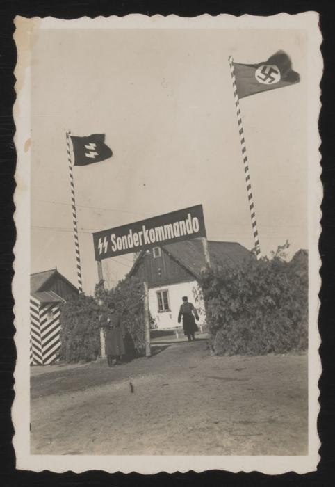
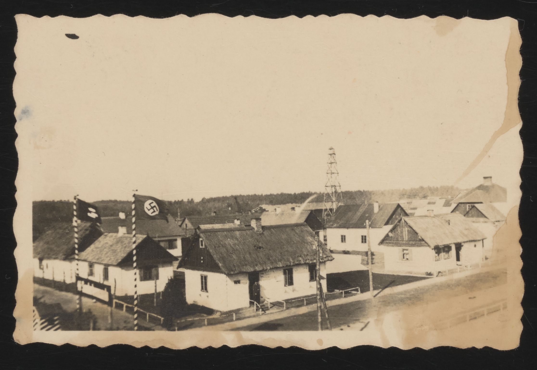
That is strange. Clearly the camp was not meant to be a secret with these two unmissable flags and flagposts raised in front of it. Here is USHMM's introduction to this photo, from the top of
their Sobibor article:
View of the Sobibor camp gate in the spring of 1943. Jews deported to the Sobibor killing center were driven through the gate into the camp on foot, by truck or horse-drawn cart. The train track led through a separate entrance to the right onto the site.
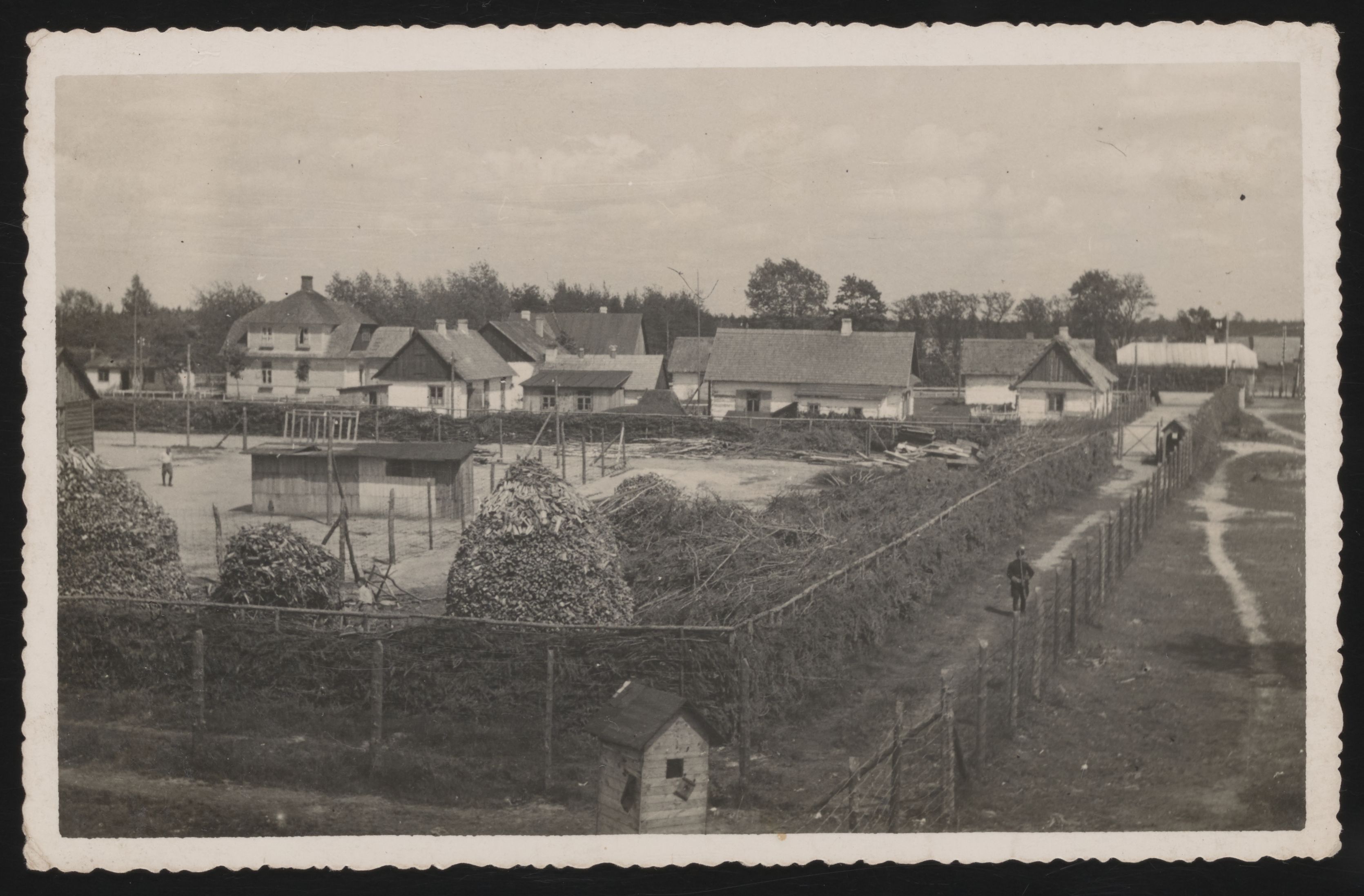
So this was the main gate with the railline running right next to it. It was therefore visible to everyone. And there was nothing sinister hidden behind the fence. It was a clean compound. Here is an elevated view from the right (east) of the gate:
And another view from the left (west) of the gate, perhaps from an earlier date:
The full extensive photo album attributed to Johann Niemann can be viewed here:
https://collections.ushmm.org/search/ca ... rsc=205184
What's remarkable about this collection is that it was supposedly unknown until 2020, which means it created an opportunity to compare the actual state of the camp against the stories of witnesses and historians. I wonder if anyone here has taken that opportunity?
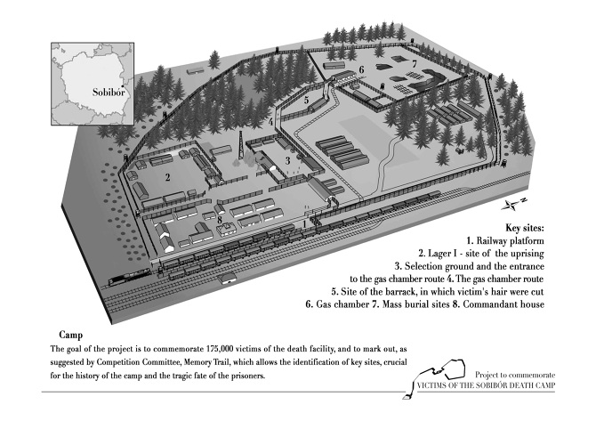
As just one quick comparison, I'm noticing that what we see in the photos does not closely match the USHMM's map.
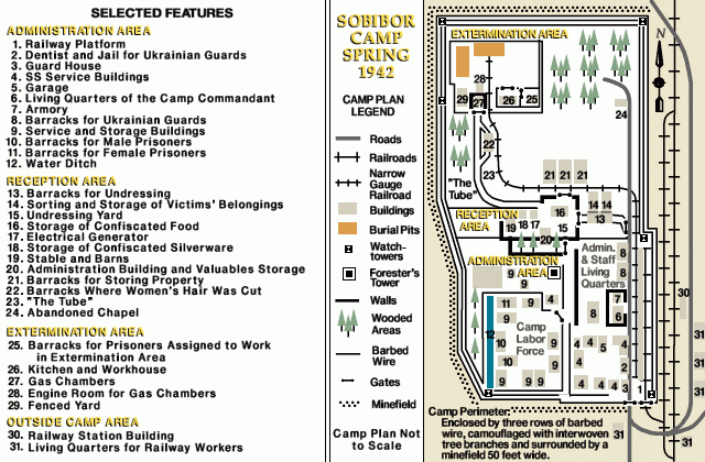
Compared to USHMM's map:
- The "three rows of barbed wire" fence were actually only one or two layers.
- The supposed "camouflage" could never function as camouflage with such short fences, nor with a giant sign and flagposts, etc.
- The watchtowers were missing. Instead there were three small booths along the front stretch.
- The minefield was not visible or marked and actually appears to have been a walking path. The photo from the left of the gate was taken from an elevated position
inside the minefield.
- Many buildings (marked 9 and 10) in the southwest area (sometimes called lager I) were missing or not yet built.
- The buildings in the southeast were, at best, incorrectly located and oriented on the map.
- The prominent roofed well near the gate was not marked at all on the map.
- The building marked "garage" did not resemble a garage, nor did its neighbors.
If they could get so much wrong, how much else of the history of the camp is just made up? And that is just a cursory comparison. Of course the claimed extermination area (sometimes called lager III) is not, as far as I can tell, pictured in any of these photos. So, considering the source, why should anyone believe in the extermination story here?